AI4EO Challenge with UNOSAT


This challenge was organised by Phi-Unet in partnership with UNOSAT a technology-intensive programme under the United Nations Institute for Training and Research. The aim of the contest, instigated by UNOSAT in partnership with RUS Copernicus and with the technical support of CERN openlab, was to put artificial intelligence and Earth Observation data at the service of a humanitarian cause: supporting the Iraqi government in planning reconstruction activities.
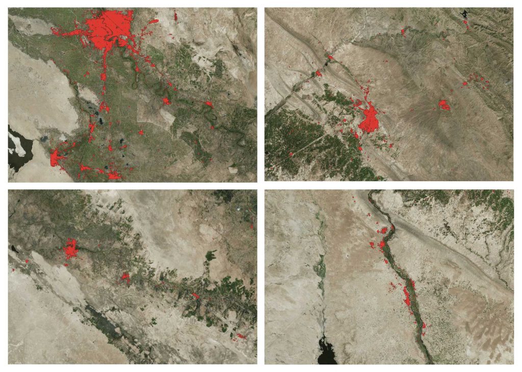
This challenge is focused on the creation and generation of the building footprints in Iraq. The building footprint request comes out of a need from the UN Populations Fund (UNFPA). UNFPA is the United Nations sexual and reproductive health agency. They are assisting the Government of Iraq to plan the October 2020 population census, which is crucial for key baseline information in support of reconstruction and development (i.e. fight extreme poverty, inequality and sexual and reproductive health problems, prevention of gender-based violence, climate change resilience). The building footprints are needed to plan the implementation of the on-site survey interviews – and the contest has two phases.
Machines with 4 cores and 16 Go RAM), or use their own computing environment to develop their workflow. The second phase (still ongoing) provides VHR 3-band natural color images for three cities, plus Open Street Map (OSM) data with a total of 722,837 building polygons.
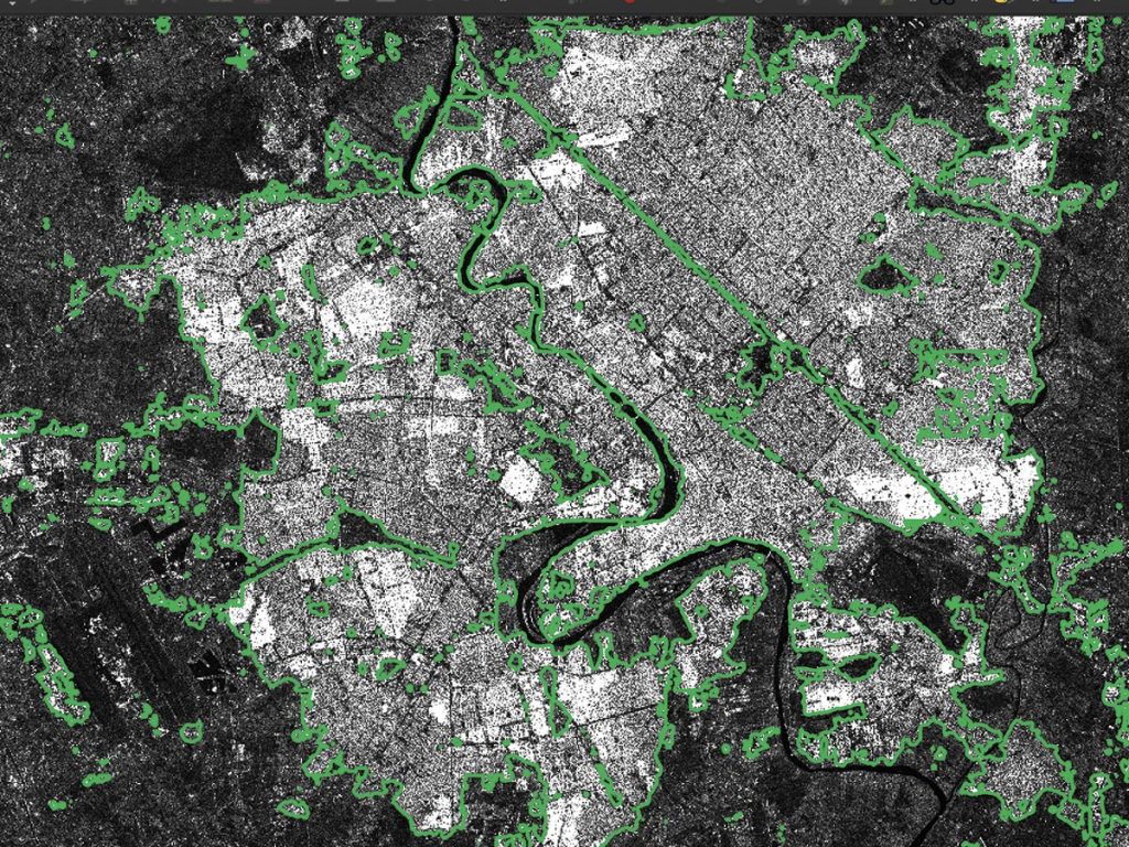
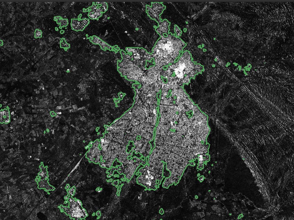
In order to process the images provided (with two polarisations – VV-VH) and to perform a semantic segmentation, some participants used a U-Net (fully convolutional network) architecture, with pre-trained VGG11 encoder or Resnet34 backbone and center dilation layer. These results have been evaluated using the F-1 score (a weighted average of the precision and recall). Phase 2 results will be released in early April.